Get Your Free Chicago Poster

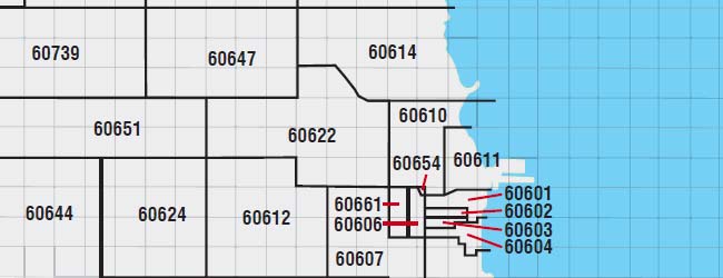
It’s easy to get around the city of Chicago—the city was established as a grid, using the intersection of State Street and Madison Street as the center of the map.

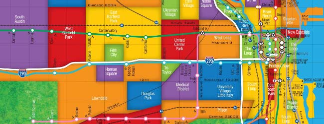
Explore the city from the comfort of your living room! This colorful map shows you each of the city’s exciting neighborhoods — and we’ll send you one absolutely free.

This site is protected by reCAPTCHA Enterprise and the Google Privacy Policy and Terms of Service apply.

Chicago Zip Code Map

Within the city limits there are close to 60 different Chicago zip codes—many of which do not coincide with recognized neighborhood boundaries.

Chicago Transit Authority (CTA) Map

The CTA regulates Chicago's public transportation. The CTA services the actual city of Chicago as well as many of the nearby suburbs. Over 1.5 million commuters use CTA transportation every day.